Add route points in operational order
Create loading, unloading and intermediate points in the sequence the truck should visit them.

Use LogicCalc as a truck route calculator and road-freight route planner for European transport. Add the truck base, loading and unloading points, intermediate stops and optional avoided countries, then review route distance, country segments, transit time, toll estimates and route economics.
A road-freight route often contains more than one origin and destination. LogicCalc keeps every operational point and the resulting route economics connected in one plan.
Create loading, unloading and intermediate points in the sequence the truck should visit them.
Include the vehicle starting base when needed and request supported alternative routing around selected transit countries.
Check total distance, country breakdown, empty positioning, driver-time estimate, tolls, operating cost and customer price.
Total planned truck distance = empty positioning + every loading, unloading and intermediate route leg
LogicCalc is designed for transport planning rather than generic car navigation, so the route can be connected to operational and commercial calculations.
Plan more than one loading or unloading point and keep intermediate stops in the required order.
Calculate the empty positioning leg from the vehicle base to the first operational point.
Review total road distance and distance by country for the complete planned movement.
Request a supported alternative route that excludes selected transit countries when the routing workflow can provide one.
Use the complete distance to estimate driving time, required pauses, daily rests and total elapsed transport time.
Feed country distances into freight cost, toll and customer-pricing calculations in the same workspace.
Assume the truck starts 80 km from collection, travels 540 km to the first unloading point and another 210 km to a second delivery.
The complete planned movement is 830 km. The 80 km deadhead remains visible while still contributing to time, fuel and route economics.
| Truck route leg | Example distance |
|---|---|
| Truck base to loading | 80 km empty |
| Loading to first unloading | 540 km |
| First to second unloading | 210 km |
| Loaded and intermediate distance | 750 km |
| Complete planned distance | 830 km |
Illustrative distances only. Actual routing depends on geocoding, available road data, route settings and current road availability.
Every loading, unloading and intermediate stop stays in the route order required by the transport plan.
Country segments can support local kilometre rates, toll planning and cross-border route review.
Deadhead distance is shown separately instead of disappearing inside a single total route number.
Changing the route can immediately change distance, country rates, toll assumptions, time and final price.
LogicCalc provides a road-freight route planning workspace with multi-stop routing, country distance, empty positioning, time, toll and transport-cost calculations.
Yes. Multiple loading, unloading and intermediate points can be added in the order the truck should visit them.
LogicCalc can request an alternative route excluding supported selected countries. Availability depends on the routing service and route geometry.
No. It is a road-freight planning tool and does not guarantee clearance for a specific truck height, weight, axle configuration or local restriction.
Yes. Route distance can feed country-rate costs, estimated tolls, driver time, fuel, fixed expenses and customer pricing.
This is a real LogicCalc workspace view. Use your own route, cargo, fleet and commercial settings for the actual calculation.
Open LogicCalc →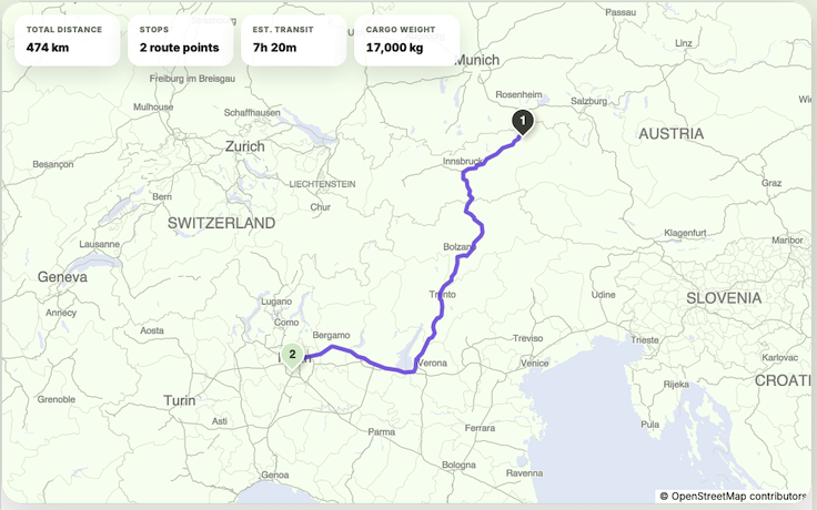
Explore route planning, transport pricing, cargo, driver-time and sustainability tools in one connected workspace.
Add every operational point, calculate the complete movement and keep country distance, timing, tolls and freight economics connected.
LogicCalc is not certified turn-by-turn HGV navigation. Verify bridge heights, weight limits, environmental zones, temporary bans, local access, ferries, border conditions and vehicle-specific restrictions before dispatch.