Calculate the baseline route
Add 2–4 loading, unloading or intermediate points and calculate the normal route first. This fixes the stop order, vehicle profile and commercial settings used for a fair comparison.

Start with the route you would actually dispatch. LogicCalc then builds distinct alternatives, validates each corridor, and compares the complete trip rather than judging one leg in isolation.
Add 2–4 loading, unloading or intermediate points and calculate the normal route first. This fixes the stop order, vehicle profile and commercial settings used for a fair comparison.
LogicCalc requests alternative geometry for each route leg, rejects duplicate or invalid candidates, and checks the country-distance breakdown before an option can enter the shortlist.
Valid legs are combined into end-to-end options and evaluated by distance, driving time and internal cost. Preview the corridor on the map, then select the route that best fits the dispatch priority.
Use route comparison when the corridor itself can change cost, timing or operational confidence. These three cases are where a side-by-side view is most useful.
Use this when you need to see whether an alternative motorway or country corridor changes the whole trip, not just one leg. LogicCalc validates each alternative geometry before it can enter the shortlist.
Use the Cheapest and Fastest comparison when the shortest route is not automatically the best commercial choice. Compare distance, driving time and internal cost side by side before selecting an option.
Preview an alternative on the map before switching so you can confirm the actual corridor and stop order. Once selected, that geometry becomes the active route used by the rest of the calculation.
Hypothetical planning example: Recommended — 590 km, 7 h 35 min, €860 internal cost; Cheapest — 620 km, 7 h 55 min, €835; Fastest — 605 km, 7 h 10 min, €885. The figures are illustrative, but the decision is real: the shortest, cheapest and fastest options do not have to be the same route. Check the corridor on the map before switching.
LogicCalc compares validated end-to-end route geometries for the same stop order. The shortlist is evaluated with the current route settings using distance, estimated driving time and internal cost, so the alternatives are comparable on the same basis.
A few extra kilometres can still reduce internal cost if the corridor has a different toll profile, road mix or operating-time trade-off. That is why distance alone is not used as the commercial decision.
The selected geometry becomes the active route used by the rest of the LogicCalc calculation. Preview it first so the corridor and stop sequence are what you expect before you switch.
Alternatives are not generated while Avoid Countries is active, and the routing service may also return no distinct candidate that passes LogicCalc’s geometry and country-distance validation.
Route comparison is a planning aid, not live truck navigation. Before sending the route to a driver, verify the operational details that can change after the calculation.
This is a real LogicCalc workspace view. Use your own route, cargo, fleet and commercial settings for the actual calculation.
Open LogicCalc →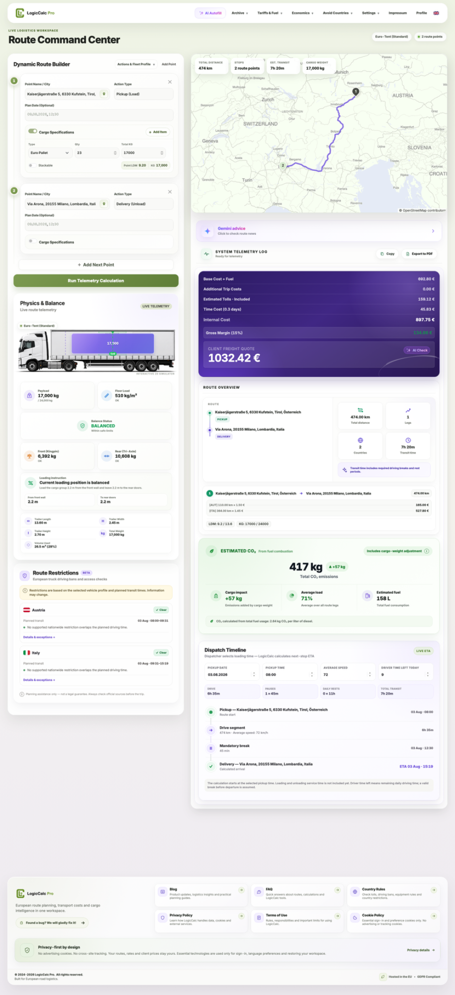
LogicCalc is a planning tool. Always verify operational, legal and contractual requirements for the actual transport.